All entries for Wednesday 02 October 2013
October 02, 2013
Have you heard about? The Down Survey of Ireland
Writing about web page http://downsurvey.tcd.ie/
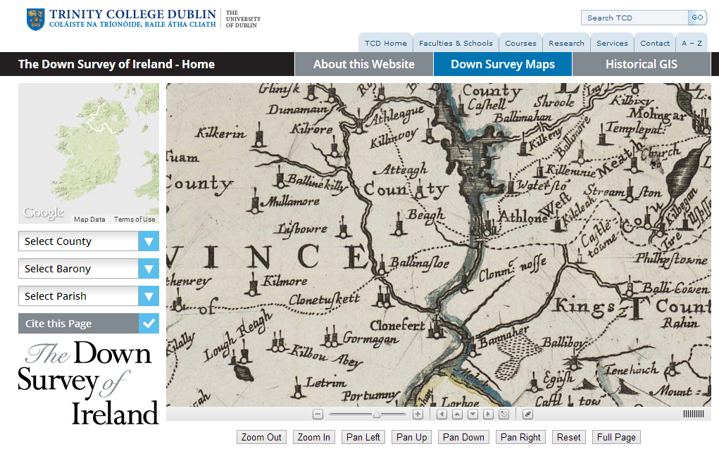
The website is the major output from a project funded by the Irish Research Council under its Research Fellowship Scheme, which ran from 1 October 2011 to 31 March 2013. First, surviving copies of county, barony and parish maps were identified and digitised. Then, they were combined with nineteenth century OS maps and twenty-first century satellite images (from google earth) to provide a multiple-scale seamless map of Ireland
These digitised maps provide the backbone of the project, and are a resource in themselves, but to my mind the most interesting thing is the data that has been overlaid onto them from sources such as the 1659 census and 1641 depositions (which have themselves been transcribed and digitised- http://1641.tcd.ie/). This, as in the example below, allows us to “see” land ownership by religion in 1641 and 1670:
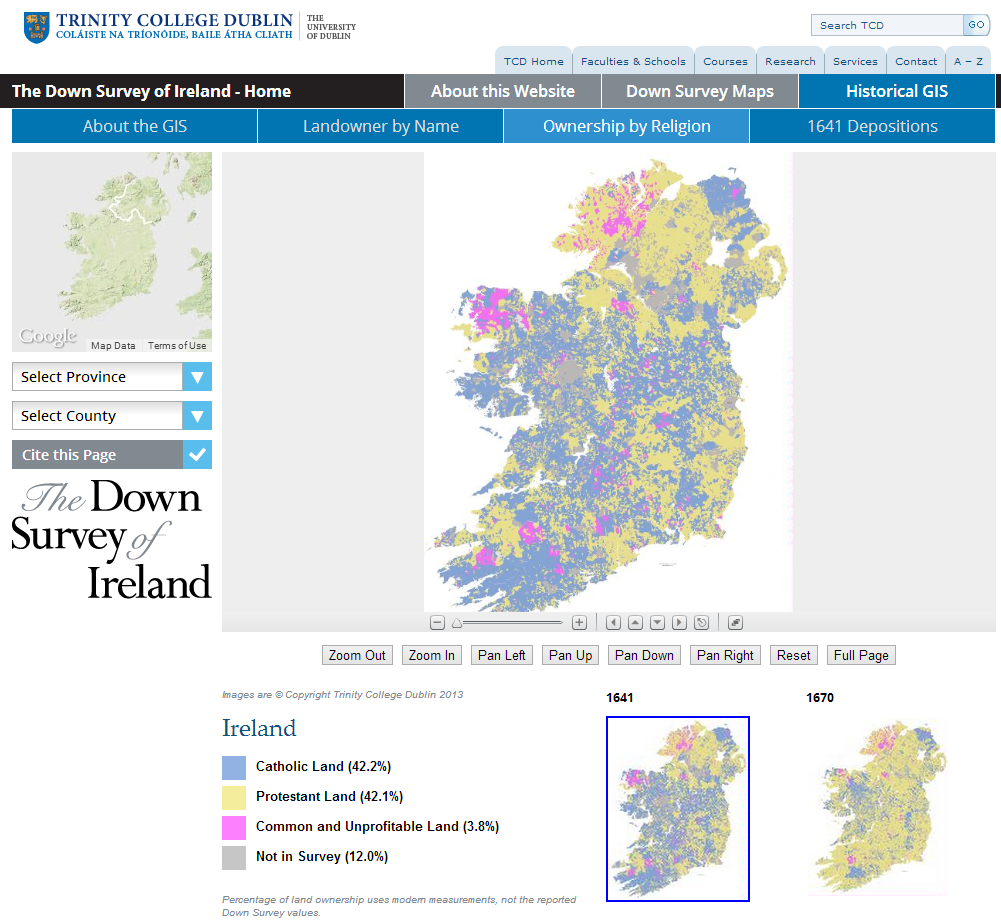
Basically, it’s a great example of what Historical GIS can do.
And for the technophiles among you- the sections on Historical GIS (http://downsurvey.tcd.ie/historical-gis.html) contain an admirable amount of information both on the construction of the dataset and the user interface.
If you are interested in a similar project, get in touch with the Digital Humanities team and see how we can assist.
 David Beck
02 Oct 2013 09:16
|
David Beck
02 Oct 2013 09:16
| ![]() Tags: Geography Gis History Mapping
|
Tags: Geography Gis History Mapping
|  Comments (0)
|
Comments (0)
|  Report a problem
 Please wait - comments are loading
 Loading…